 |
 |
 |
|
|
|
|
Canadian Train Bridges and Trestles
Quebec and Ontario
| I decided to write this page on railway bridges after
a visitor Arthur Grieve, Winnipeg, Manitoba offered
to give me a number of railway bridge pictures that he had collected.
I again hope that my visitors will be sending me their pictures to be included on this page.
|
|
|
|
|
|
|
|
|
 |
 |
|
|
|
Quebec
 |
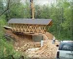
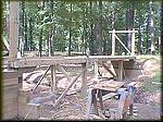
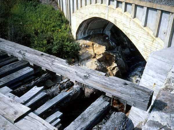
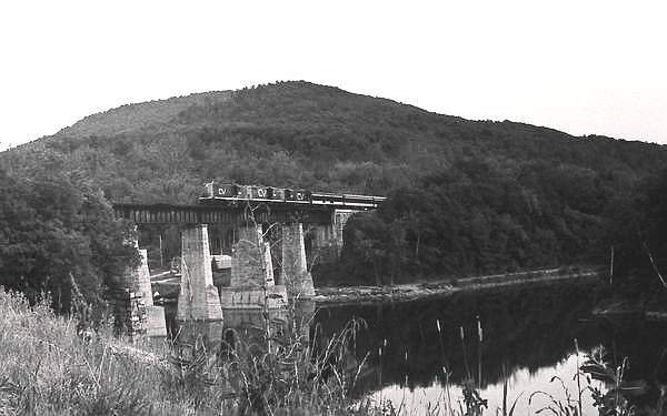
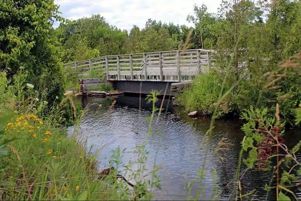
| The Harstone trestle is being studied for removal,
replacement or refurbishment. This bridge, constructed in 1922, is one
of the few remaining traces of the historic Port Arthur, Duluth and Western
(Pee Dee) Railway. The replacement of the bridge would mean the loss of
an important piece
of the history of the area. |
Join me on facebook
so that you can keep up with all the changes to
this page and all the rest that make up Old Canadian
Railways
Old
Canadian Railways
Promote
Your Page Too
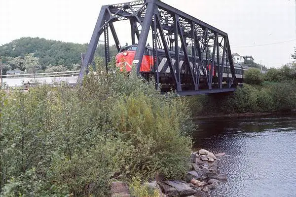 |
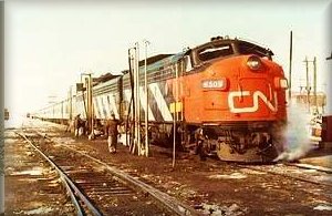
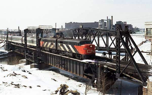
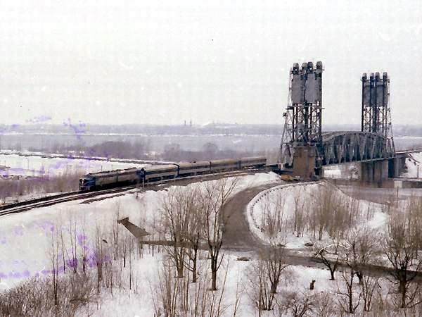
This view, dated June 1974 shows a couple of diesels providing
the link between Montréal and Chicoutimi, about 140 miles north
of Québec in the region now called Ville de Saguenay, now composed
of the former towns of Jonquière, Chicoutimi and La Baie.
CN and then VIA provided service dating back to almost
The Rivière Chicoutimi flows under the bridge, providing hydroelectric power, specifically for smelting aluminum at the former ALCAN (now Rio Tinto) plant in the Arvida district of Jonquière (home to the Roberval Saguenay Railway - mfj). The area pictured is the outlet into the Rivière Saguenay about a mile away. In July 1996, one of the many dams burst, sending 11
Montréal - Chicoutimi in the 1970s, was a lonely 318-mile
ride with only day coach seating and no diner, as the train traversed a
provincial park for at least 200 miles. The
|
| This picture was taken and submitted by Massey F. Jones | |
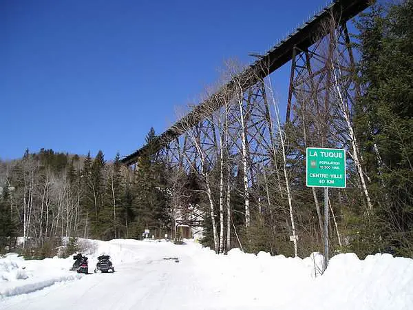 |
"du Milieu" river trestle. Gaétan took the picture
on
23 March 2005. It is located 40 km south of La Tuque. From Via Rail literature, it's the highest in Québec at 60 m, 121 m long and built in 1907 |
| This picture was taken and submitted by Gaétan Gagnon | |
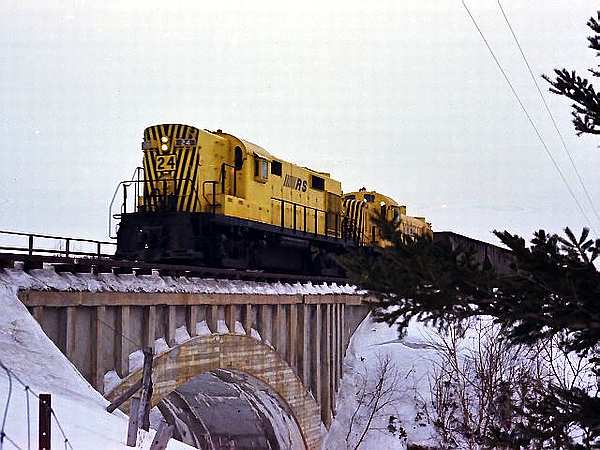 |
Roberval Saguenay and RS3 locomotive cross a
concrete bridge over a small set of falls, near Chicoutimi QC (now Saguenay) in the late 70s, outbound with aluminum ore (bauxite) from their dock at Grande Baie (Port Alfred) to the smelter at Arvida on one of their frequent runs. The bridge replaced an adjacent almost centenary wood bridge which had rotted. Like all the locomotives on its roster up to about the early
|
| Massey F. Jones collection | |
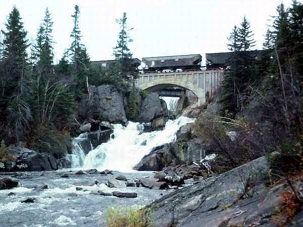 |
The Roberval Saguenay concrete bridge, probably constructed in the 1950s; when the deck of the old structure partly seen under the arch, became inadequate to support heavier loads. This view dates from around 1980. The advantage of this type of bridge is that it is extremely solid and requires low maintenance. Note the very heavy and reinforced bridge abutment. The surrounding rock is granite. |
| This picture was taken and submitted by Massey F. Jones | |
 |
The old bridge in the foreground might have been
constructed as early as 1909, when the Ha!-Ha! Bay Railway Company was formed; the ancestor of the present Roberval Saguenay Railway http://www.trainweb.org/oldtimetrains/RS/history.htm It originally carried steam locomotives and possibly
In 1925, Alcan opened an aluminum plant in the area,
|
| This picture was taken and submitted by Massey F. Jones | |
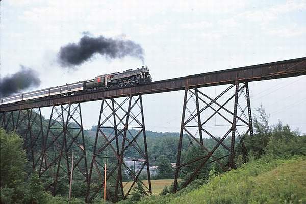 |
Ste Ursule Falls trestle QC with CN 6060 crossing on a runpast, during a railfan trip with the St Lawrence Valley Chapter of the Canadian Railroad Historical Association (CRHA) in the mid-70s. Situated in the Mauricie area of Quebec close to
Built by The Grand Trunk Railway (CN precursor) in
While the bridge is off-limits to pedestrians, the area
|
| This picture was taken and submitted by Massey F. Jones | |
 |
Bristol Mines Trestle, 1982 It is on a siding to
Bristol Mines at Wyman Quebec |
| This picture was submitted by Bill Erwin | |
 |
These Dayliners are shown on one of the bridges out of Montreal's
West Island and are ancestors of the present
AMT Montreal-Rigaud service. |
| This picture was taken and submitted by Massey F. Jones | |
 |
A CN passenger train passes over this Lachine Canal in downtown
Montreal, minutes before entering into
Central Station/Gare Centrale http://en.wikipedia.org/wiki/Central_Station_(Montreal), where all VIA Rail trains now arrive and depart. The metal structures (since removed), were used to support the catenary for early operation of CN electric engines operating through the Mount Royal Tunnel on the other side of the station. This was one of their storage area. This large heavy bridge is an upgrade from the
All the area under the bridges has now been reclaimed
|
| This picture was taken and submitted by Massey F. Jones | |
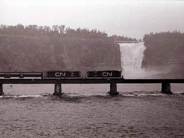 |
CN Geeps 4101 and 4105 on a runpast in front of
Montmorency Falls during a St Lawrence Valley Railway Society CRHA excursion in the late 1970s Located just a few minutes from downtown Quebec City, half times higher than Niagara Falls and 150ft (45.7m) wide. The falls flow into the St Lawrence River. |
| This picture was taken and submitted by Massey F. Jones | |
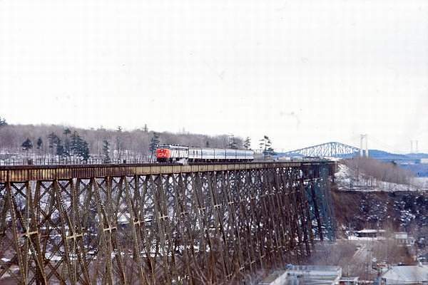 |
A CHRA fantrip brought Montreal railfans to the Cap Rouge
trestle near Quebec City during summer 1978.
Visible in the background is the Pont de Québec /Quebec Bridge (combined road/rail bridge) and Pont Pierre Laporte (the white pillars), a vehicle bridge. The Cap Rouge Trestle (translated to Red Cape
When the NTR became absorbed in the Canadian
|
| This picture was taken and submitted by Massey F. Jones | |
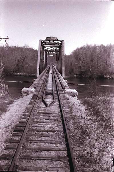
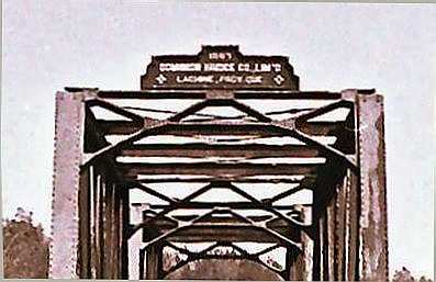 |
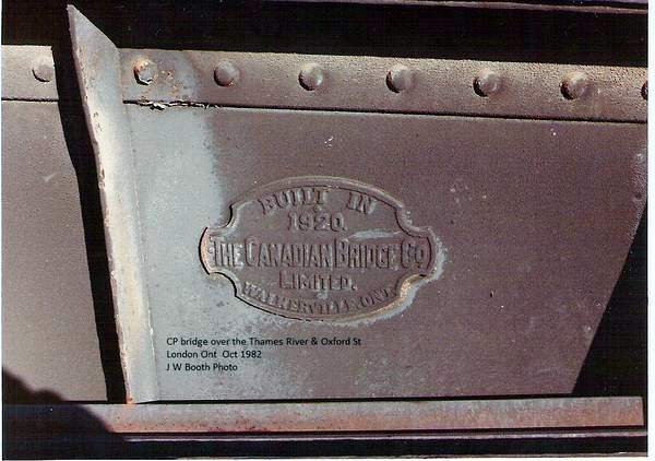
The name plate for the bridge shown below
The date sign over the bridge reads:
|
| This picture was taken and submitted by Massey F. Jones | |
|
|
This view was taken through the front cab of an
RDC during a railway fantrip in the mid 70s. Our train is about to pass through an old iron bridge at Fort Coulonge QC (west of Ottawa in Pontiac County) and will let us out on the other side while the train backs up for a runpast on the bridge. That's when it goes full speed in front of the crowd, with all bells and whistles going. Fans take pictures, video; some record the sound, others just look. Then everyone re-board and makes ready for the next runpast at another historical place where it's safe for for all to stand trackside. This old iron truss railway bridge carried the Pontiac Pacific Junction
railway over the Coulonge River until 1902, and then the CPR until 1978.
The date sign over the bridge reads:
http://www.waymarking.com/waymarks/WM9N5V_
|
| This picture was taken and submitted by Massey F. Jones | |
 |
Dayliner CP 9064 almost at the end of a runpast on the
Fort Coulonge Bridge during a St. Lawrence Valley (CRHA) fantrip during the mid-70s. Shortly thereafter, the line was due to be abandoned by CP. The purpose of the fantrip was to have a ride on a line before the rail was torn up. Fort Coulonge is named after Nicholas d'Ailleboust, Sieur
|
| This picture was taken and submitted by Massey F. Jones | |
 |
A CNR Steamer crossing the Richelieu River.
This picture was taken from ther west side of the river and the train has just left Beloeil and is heading east, mid 1940s |
| This picture was submitted by Norman Baker, Kingston ON | |
 |
A CNR Steamer crossing the Richelieu River
heading east. The picture was tas taken from the beach at Otterburn Park on the east side of the river, The train has just left Beloeil, 1953 |
| This picture was submitted by Norman Baker, Kingston ON | |
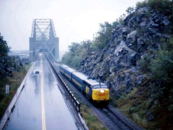 |
One of the VIA FPA-4 diesel in the 6700 series, alongside Boulevard
Laurier, exiting the Quebec Bridge
(Pont de Quebec) on a very rainy day in the very early 80s; outbound from Montreal, into Gare du Palais in downtown Quebec, on the still popular VIA "Corridor". Seeking to compete with GMD for the passenger loco
|
| This picture was taken and submitted by Massey F. Jones | |
 |
Alco PA-1s 17 and 19, lead the Delaware & Hudson's Laurentian
between New York City and Montreal,
inbound into Montreal around St. Lambert QC, having just passed the locks on the St. Lawrence Seaway. The PA-1 is the most famous model in American railroad history. Notice the long nose. |
| This picture was taken and submitted by Massey F. Jones | |
 |
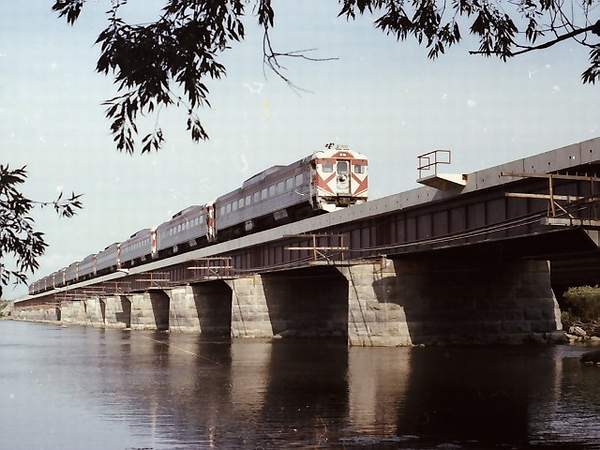
The south end of Victoria Bridge at St. Lambert,
July 1974. The raised span of the bridge and the road gate to the right in the down position, indicate that a ship is somewhere in the vicinity through St. Lawrence Seaway. Built in 1859 to link Montreal and the South Shore, Victoria Bridge is still very much in use by road and rail today. http://en.wikipedia.org/wiki/Victoria_Bridge_(Montreal) Further to the left in the photo is the St. Lambert
At one time, Victoria Bridge hosted tracks of the
While service was frequent, the M&SC, with their early-1900
While the equipment was very outdated, M&SC
Also compare the web photo of the first M&SC trip on
|
| This picture was taken and submitted by Massey F. Jones | |
 |
A portion from a French copy of Perly's 1983 map book,
showing the south end of Victoria Bridge and the St. Lambert Diversion.
http://www.perlys.com/oms-tour.php |
| Submitted by Massey F. Jones | |
 |
A Google Earth view of the main CN alignment
(straight line) and the diversion (curved). Both bridges are able to accommodate road and rail traffic. View an extensive history of Victoria Bridge in English, including several old time photos at: http://www.memorablemontreal.com/accessibleQA/en /bridges/?id=176&menu=histoire |
| Google earth Image submitted by Massey F. Jones |
Ontario
 |
Alvinston Bridge
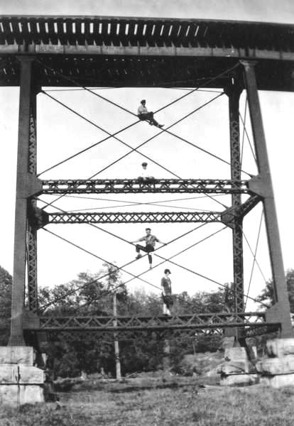
Jim had this to say about this picture. "This is only the second photograph of the bridge that I have found. It is nice and clear and shows the steel construction. Judging by the dress - particularly of the girl and her hair style, I would suggest it is from the 1920's or 1930's. When I was a kid I always thought it would be cool to climb up on some of those style girders, but I never had enough nerve! The photo came from a lady who lived at Gray's Siding, just about 2 miles from the bridge. The line was the GTR Kingscourt cutoff which ran from Glencoe, through Alvinston to Kingscourt on the line from Sarnia to London. The line was abandoned and the bridge removed in the late 1960's." |
| This picture was submitted by Jim Griffin, Markdale ON | |
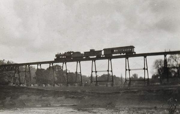 |
CNR Kingscourt Branch Bridge near Alvinston, ON.
It was built 1898 and was taken down in 1965
|
| This picture was submitted by Jim Griffin, Markdale ON | |
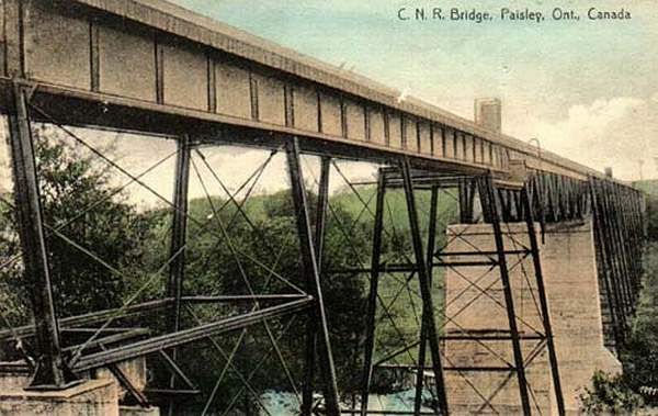 |
GTR Bridge Paisley, ON |
| This picture was submitted by Jim Griffin, Markdale ON | |
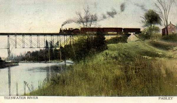 |
GTR Bridge Paisley, ON |
| This picture was submitted by Jim Griffin, Markdale ON | |
 |
GTR Bridge Paisley, ON |
| This picture was submitted by Jim Griffin, Markdale ON | |
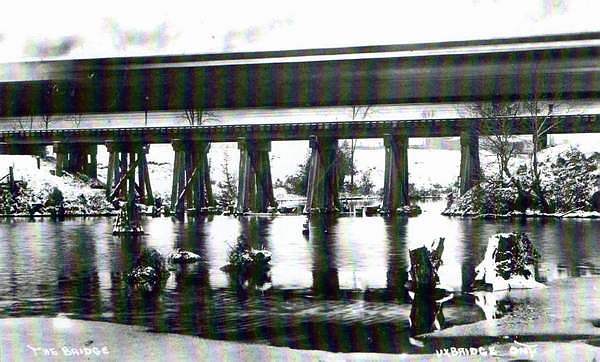 |
GTR Bridge Uxbridge, Ontario.
The picture was taken in 1886 by local photographer, A. J. Lord. The blur of a train can be seen crossing the bridge.This bridge still exists although the tracks here have been removed. The bridge crossed a creek and mill pond, and was known as the "Big Bridge" or "Big B," especially by those who went there to swim. An important fact today is that the Trans Canada Trail enters Uxbridge from the east on the former railway right-of-way, and crosses over this bridge which is just east of Main Street North. Allan McGillivray, Uxbridge Twp. historian. The
Toronto and Nipissing Railway originally built
|
| Thgis picture was taken by local local photographer of the day , A. J. Lord and was submitted by Allan McGillivray, Uxbridge Twp. historian. | |
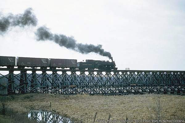 |
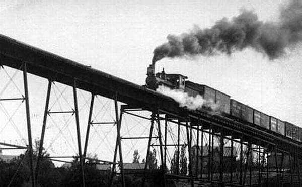
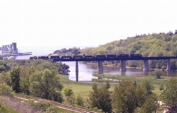
Canadian Pacific steamer pulling freight on the line
from Coldwater, Ontario across the Hogg's Bay Trestle or Hogg's Bay Trestle (1908 to 1978} into Port McNicoll's grain elevators in the 1960's The Hogg�s Bay Trestle was built in 1908 to service the Canadian
Pacific Railway line when it moved its
|
| This picture was submitted by Doug Binns, Coldwater, Ontario | |
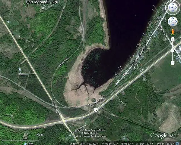 |
The scar at the bottom right of this Google Earth
satellite picture gives a fairly good idea of how the track led to the dock on the Hoggs trestle at Port McNicoll. Follow it from the right side through the water and into the dock on the left picture. The right picture shows the trails now present around the trestle; the curved one about centre, is named "Trestle Trail". Hogg Bay is an arm of Georgian Bay that some name "Hog Bay" today. Coldwater described in another photo, is about half-way between Port McNicoll and Orillia. See my station page to find out more about Port McNicoll |
| Submitted by Massey F. Jones | |
 |
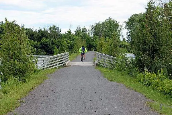
An entrance to the Tay Shore Trail on Hwy 12 from Orillia
to Midland, brings visitors to the main pier on the shore, which formerly anchored the Hoggs Bay trestle. A further walk left along the trail towards Port McNicoll brings hikers into what is called "The Trestle Trail" portion. The Tay Shore Trail is a 17 km of abandoned CN rail corridor. It is part of the Trans-Canada Trail. This Google Street View looks northwest. |
| Submitted by Massey F. Jones | |
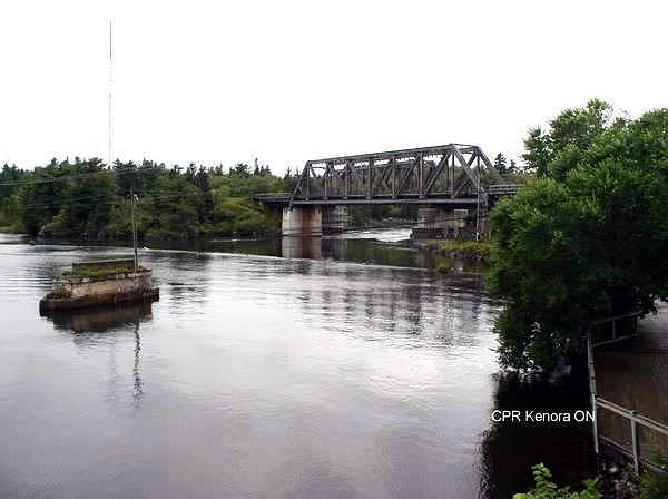 |
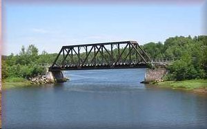
CPR Train Bridge at Kenora ON
CPR bridge spanning the Winnipeg River at Kenora ON.
|
| This picture was taken and submitted by Arthur Grieve, Winnipeg, Manitoba | |
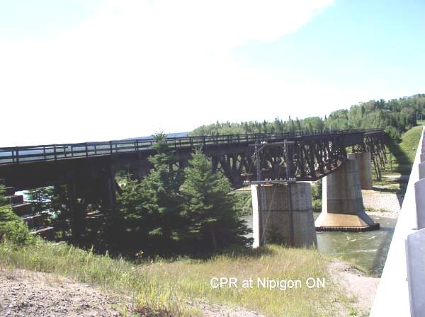 |
CPR Train Bridge at Nipigon ON
CPR bridge spanning the Nipigon River at Nipigon ON.
|
| This picture was taken and submitted by Arthur Grieve, Winnipeg, Manitoba |
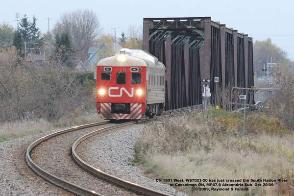 |
The South Nation River train bridge at
Casselman ON This is on the CN Alexandria sub between Casselman and Ottawa Shown crossing the bridge is CN's "Budd" Geometry Test Car 1501 enroute to Arnprior. |
| This picture was taken by Ray Farand and was submitted by Jean Guy Hamel | |
 |
CP Maitland River Train Bridge, Goderich, ON
with CP-4244 and 4242 crossing |
| This picture was taken by Bill Thomson in June 1, 1984.
It was submitted by Jean Guy Hamel |
|
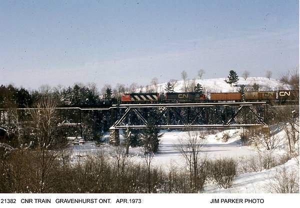 |
CNR Bridge Gravenhurst Ont. April 1973 |
| This picture was taken and submitted by Jim Parker | |
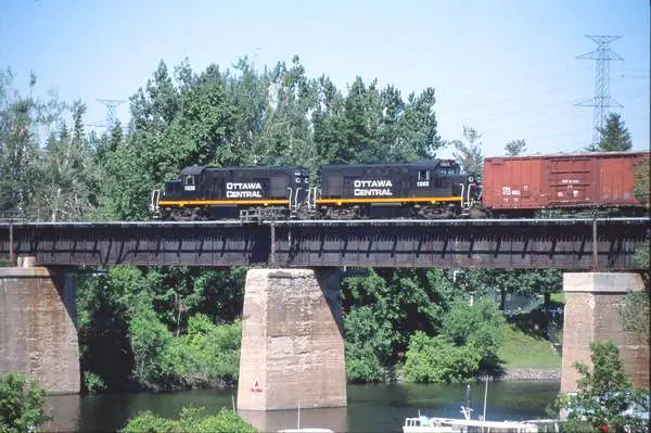 |
Ottawa Central Rideau River Bridge |
| This picture was submitted by Jean Guy Hamel |
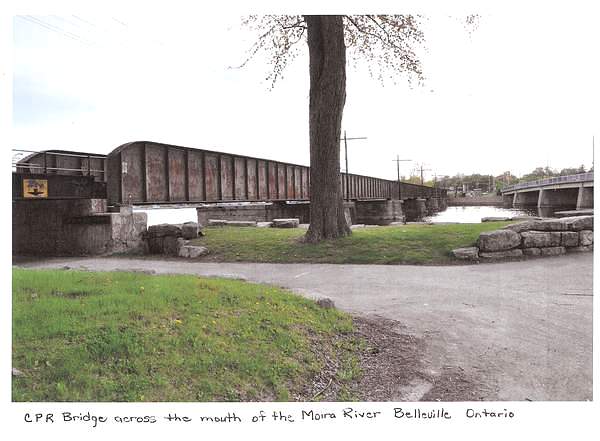 |
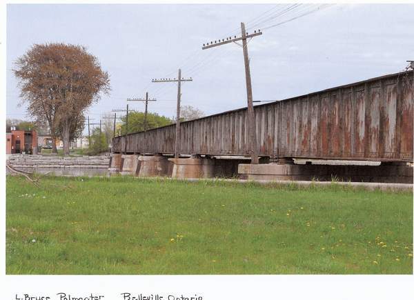
CPR Bridge across the mouth of the Moira River
in Belleville Ontario |
| This picture was submitted by L. Bruce Polmanter, Belleville, Ontario | |
 |
CPR Bridge across the mouth of the Moira River in Belleville Ontario |
| This picture was submitted by L. Bruce Polmanter, Belleville, Ontario | |
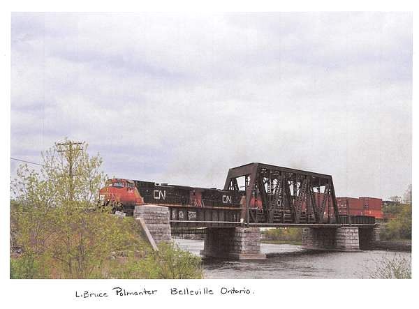 |
CNR Bridge across the Moira River in Belleville Ontario |
| This picture was submitted by L. Bruce Polmanter, Belleville, Ontario | |
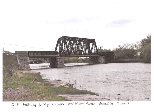 |
CNR Bridge across the Moira River in Belleville Ontario |
| This picture was submitted by L. Bruce Polmanter, Belleville, Ontario | |
 |
An Essex Terminal Railway (ETR) diesel locomotive
crossing the steel bridge over the Canadian Southern Railway (CASO) tunnel, around 1975. Built almost a century ago, the tunnel has been used by the Michican Central Railroad , New York Central and its successors Penn Centraland Conrail to ferry freight betweenWindsor and Detroit. It continues to be used today to ferrygoods between Canada and the US and the bridge continuesto be in almost daily use by the ETR, linking theirOjibway Yard, and the interchange to CN and CP in Windsor. To view a CP train exiting the CASO tunnel, go to http://www.youtube.com/watch?v=WCdsNefVuaI
|
| This picture was taken and submitted by Massey F. Jones | |
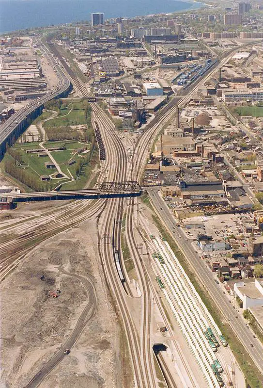 |
The Bathurst Street bridge is one of the choicest places from observing
lots of rail in Toronto.
Located within the downtown core, this unassuming streetcar bridge that has been there for decades. http://en.wikipedia.org/wiki/Bathurst_Street_Bridge I took this Kodachrome shot for myself in the 1970s or so, while on a mission to photograph for CNE planning (flypasts, paratroop) by the military. (Actually, it's possible to get just about the same thing from the CN Tower, which we circled many times) The tracks on the bottom left, lead to the CP John Street Roundhouse,
while those on the lower right go to CN Spadina Roundhouse.
The scene changed a lot over the next 20 years.
|
| This picture was taken and submitted by Massey F. Jones | |
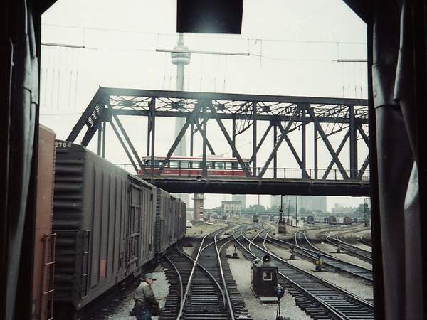 |
The Bathurst Bridge shown from track level, taken fron the front
of a Dayliner, heading into Union Station.
The VIA passenger cars in Spadina Yard would date this photo about 1978, when VIA Rail was formed. In the background, behind the coaling tower is the Spadina Avenue Bridge. Also seen in the background is the CN Tower. Yet to be built (in 1989) is the Skydome (later Rogers Centre). Special features of the photo include a very clear view of the turnouts
(switch) alignment, period boxcars and the CN Spadina Roundhouse on the
right side (notice the red nosed yard switchers.
Above the bridge and intersecting the CN Tower are barely visible
"telltales". A tell-tale is a series of ropes suspended over the
tracks above the height of a boxcar.
My research established that the first Canadian Light Rail Vehicles
(CLRV) were intoduced on the TTC in 1979 and this would be one of the early
ones. As this is a scan from
We are about to leave the Toronto Terminals Railway tracks and proceed
on the mainline. In the aerial photo, this would be about the centre
of the photo, alongside Old Fort York.
|
| This picture was taken and submitted by Massey F. Jones | |
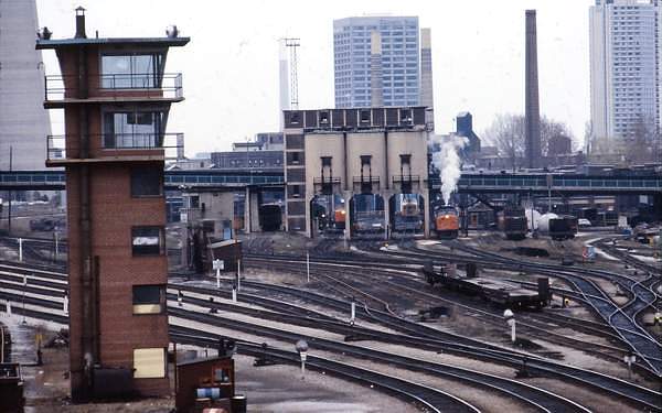 |
The CN Spadina Yard, still in full operation May 1980 in
a view feom the Spadina Avenue Bridge.. Built in the 1920s as a servicing and repair facility, the yard was razed in 1986 and replaced by the Rogers Center (formerly The Skydome). While steam has been gone for the past 20 years or so, coaling towers
still stand at the centre of the photo.
|
| This picture was taken and submitted by Massey F. Jones | |
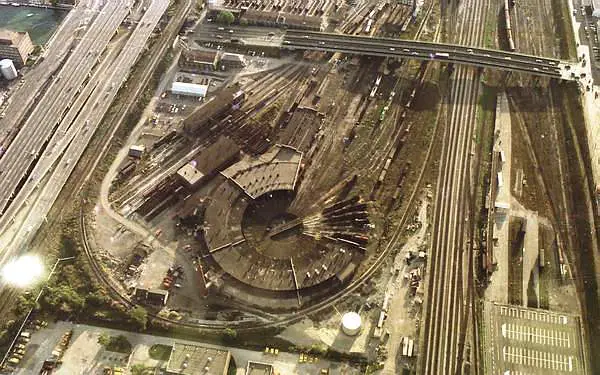 |
The CN Spadina Roundhouse, taken from the CN Tower
in the early 80s Nothing is left of roundhouse or yard, which was leveled in 1986 to make way for the Rogers Centre (formerly The Skydome). The Spadina Avenue bridge is at the top of the photo.
Still preserved in the back of the CN Tower is a portion
|
| This picture was taken and submitted by Massey F. Jones | |
 |
A lashup of Geeps 4925, 4924 and 4928 in the
High Bridge in Georgia, Vermont in the mid 70s, during a fantrip with the St Lawrence Valley Railway Society (CRHA). The units are now heading back to Montreal with us. Georgia is just south of St Albans VT, a few miles beyond the Canadian border. The bridge is about 700 ft long and spans the
A good description of the bridge and its geographical location
The bridge is still used daily by Amtrak's Vermonter,
Central Vermont was a subsidiary of the CN and it has a convulated
history dating back to the late 1800s, with
Jeff Colburn made the following comments on this bridge.
|
| This picture was taken and submitted by Massey F. Jones | |
 |
The slide caption, mentions that this pair of CP RDCs
are northbound to Toronto-Havelock in June 1980. While the destination of the train is unclear, research
|
| This picture was taken and submitted by Massey F. Jones | |
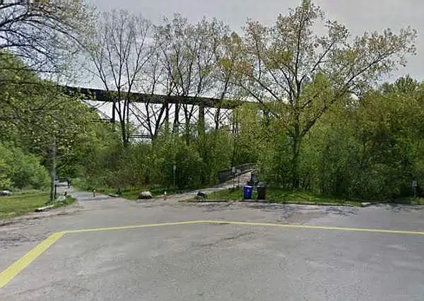 |
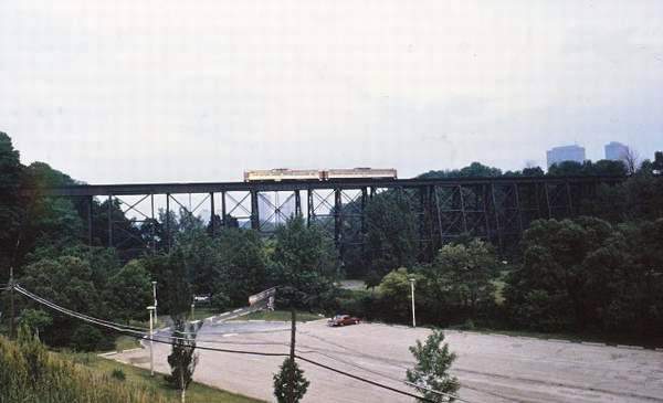
The small foot bridge in the middle of this screen,
captured from a 2015 Google Earth Street View of the parking lot at the E.T. Seton park, firmly confirms the trestle location. |
| Credit: Google Earth Street View (portion) | |
 |
In a runpast, most passenger are off-loaded at a picturesque
spot, the train backs up about a mile, then rolls past the spectators, who then reboard the train after the run. The practice isn't done much anymore, due to insurance concerns and the high price of fuel. |
| This picture was taken and submitted by Massey F. Jones | |
 |
Midland Ontario line (abandoned in the late 1990s)
trestle near Saint Marie Ontario at Saint Marie Amongst the Hurons. This part of the line is now called the Tay Shore Trail. You can see the location at http://maps.google.com/maps |
| This picture was taken and submitted by Bruce Raynor | |
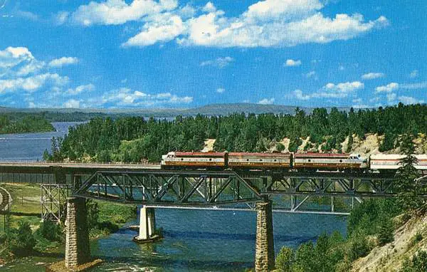 |
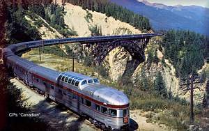
The CPR "Canadian" over the Nipigon River; from
a postcard he had sent to his folks, back in the late 1950s |
| This picture was submitted by Massey F. Jones | |
 |
CP Highway bridge, London Ontario |
| This picture was taken and submitted by Bruce Raynor | |
 |
CP Highway bridge, London Ontario |
| This picture was taken and submitted by Bruce Raynor | |
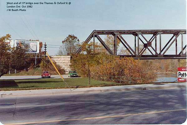 |
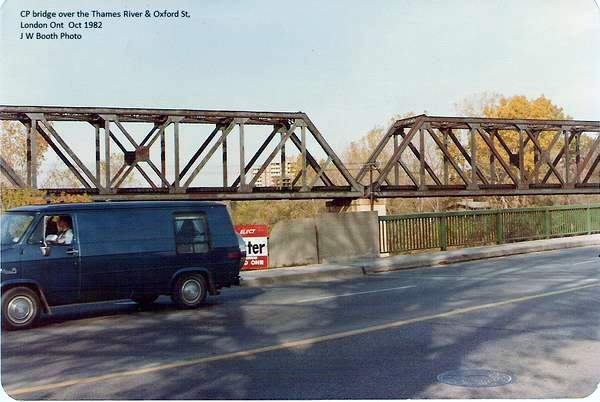
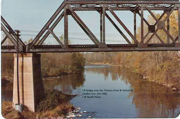
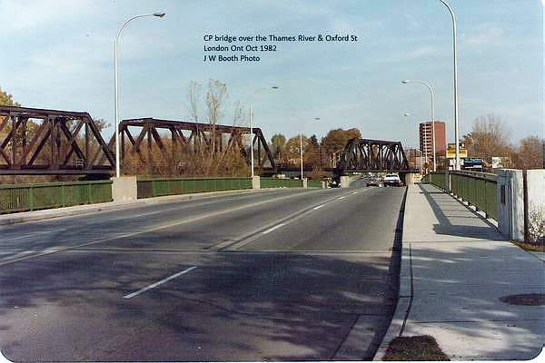
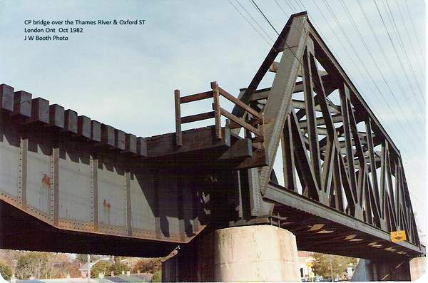
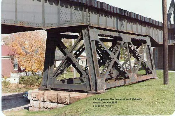
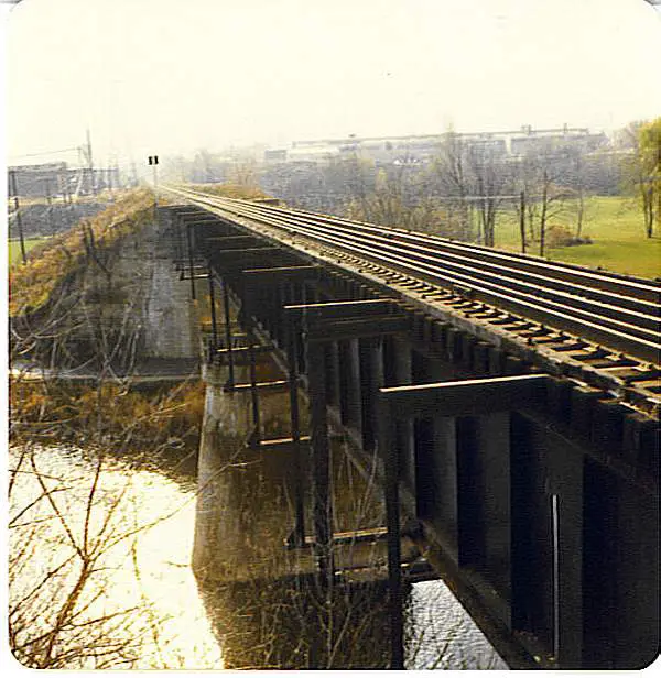
CP Bridge over the Thames River and Oxford St.
London, ON. Taken Oct 1982 |
| This picture was taken and submitted by James Booth, Willingdon AB | |
 |
CP Bridge over the Thames River and Oxford St.
London, ON. Taken Oct 1982 |
| This picture was taken and submitted by James Booth, Willingdon AB | |
 |
CP Bridge over the Thames River and Oxford St.
London, ON. Taken Oct 1982 |
| This picture was taken and submitted by James Booth, Willingdon AB | |
 |
CP Bridge over the Thames River and Oxford St.
London, ON. Taken Oct 1982 |
| This picture was taken and submitted by James Booth, Willingdon AB | |
 |
CP Bridge over the Thames River and Oxford St.
London, ON. Taken Oct 1982 |
| This picture was taken and submitted by James Booth, Willingdon AB | |
 |
CP Bridge over the Thames River and Oxford St.
London, ON. Taken Oct 1982 |
| This picture was taken and submitted by James Booth, Willingdon AB | |
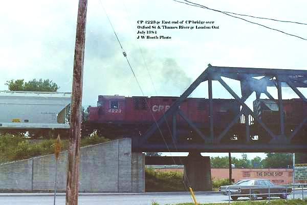 |
CP 4223 at east end of the Oxford St Bridge
London Ont July 1984 |
| This picture was taken and submitted by James Booth, Willingdon AB | |
 |
CP Bridge over the Thames River and Oxford St.
London, ON. Taken Oct 1982 |
| This picture was taken and submitted by James Booth, Willingdon AB | |
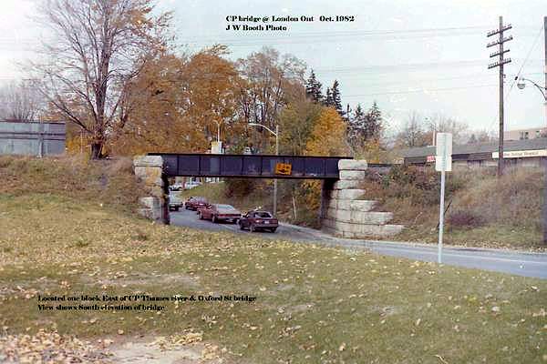 |
This two lane bridge one block East of the Thames River and Oxford St Bridge in London Ont. Oct 1982 |
| This picture was taken and submitted by James Booth, Willingdon AB | |
 |
This railway bridge belonged to the L&PS RY and crossed over
the south branch of the Thames River just south of
the L&PS RY shops. In the photograph you will notice steel brackets on the side of the bridge. When I was a teenager these brackets supported a walkway from one side of the river to the other. I used this walkway many times walking between home and highschool. The bridge was last used by CN. |
| This picture was taken and submitted by James Booth, Willingdon AB |
 |
This bridge was located on Sarnia Road between
Wonderland Road and Hyde Park, Road in London Ontario. The interesting part of this story is that this beautiful structure
was built in 1890 in St. James Manitoba and
|
| This picture was taken and submitted by Janice Bentley | |
 |
This bridge was located on Sarnia Road between
Wonderland Road and Hyde Park, Road in London Ontario. |
| This picture was taken and submitted by Janice Bentley |
| The following four pictures were submitted by Jack D. Kozlowski,
Mississauga, Ontario
and they were taken near Lakefield, Ontario. This used to be the CN rail line from Peterborough, Ontario to Lakefield, Ontario. This site is part of Silent Lake and Kawartha Highlands Parks, Ontario, Canada |
 |
Old CN railway bridge near Lakefield, ON |
 |
The righ-of-way of the Peterborou-Lakefield railway |
 |
Abandoned Swing Bridge near Peterborough |
 |
Abandoned Swing Bridge near Peterborough |
| Jack also submitted the following pictures | |
 |
CN Pickerel River Town, Rail Bridge |
| This picture was taken and submitted by Jack D. Kozlowski, Mississauga, Ontario | |
 |
CP Pickerel River Train Bridge |
| This picture was taken and submitted by Jack D. Kozlowski, Mississauga, Ontario | |
 |
CP French River Rail Bridge |
| This picture was taken and submitted by Jack D. Kozlowski, Mississauga, Ontario | |
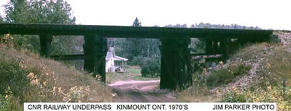 |
CNR Railway Underpass at Kinmoount Ont. 1970's |
| This picture was taken and submitted by Jim Parker | |
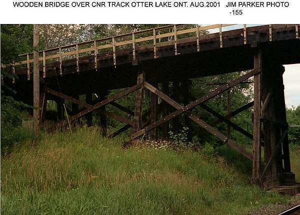 |
CNR Wooden Bridge over the CNR Tracks at
Otter Lake Ont. August 2001 |
| This picture was taken and submitted by Jim Parker | |
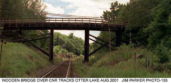 |
CNR Wooden Bridge over the CNR Tracks at
Otter Lake Ont. August 2001 |
| This picture was taken and submitted by Jim Parker | |
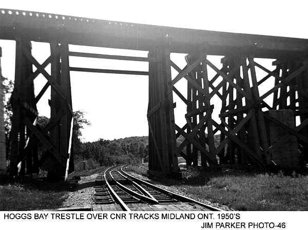 |
Hoggs Bay Trestle over the CNR tracks at
Midland Ont. 1950's |
| This picture was taken and submitted by Jim Parker | |
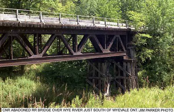 |
CNR Abadoned Railway Bridge over the Wye River just
south of Wyevale Ont. |
| This picture was taken and submitted by Jim Parker | |
|
|
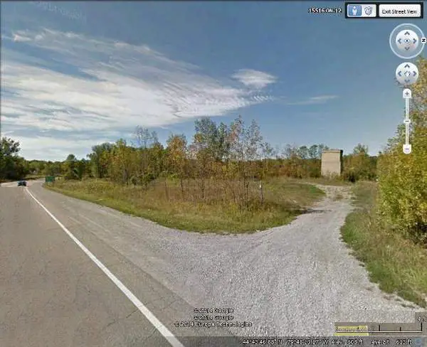
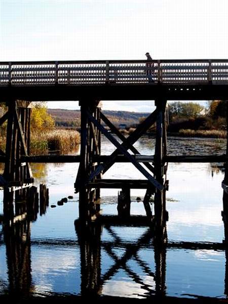
The Harstone Trestle is located 30 km west of
Thunder Bay Ontario. This trestle is located on the original roadbed of the Port Arthur Duluth and Western Railway. CNoR had the line for a while and then CNR. This trestle was built in 1922 by CNR. It crosses the Kaministiquia River, below Kakabeka Falls. |
| This picture was taken and submitted by Tim Lukinuk, Thunder Bay, ON | |
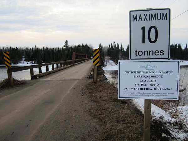 |
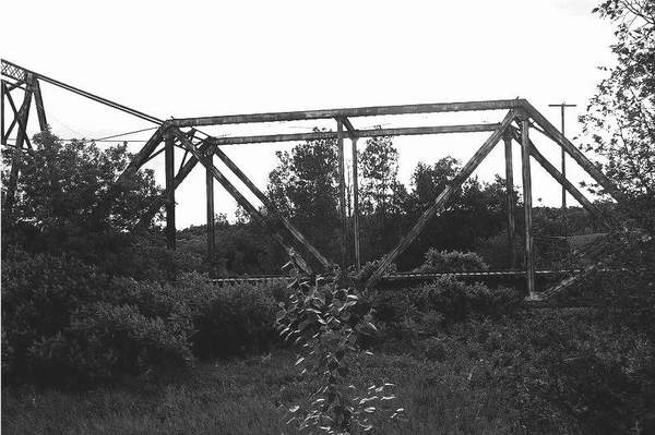
The Harstone Trestle
The Harstone trestle is being studied for removal, replacement or
refurbishment.
|
| This picture was taken and submitted by Tim Lukinuk, Thunder Bay, ON | |
 |
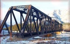
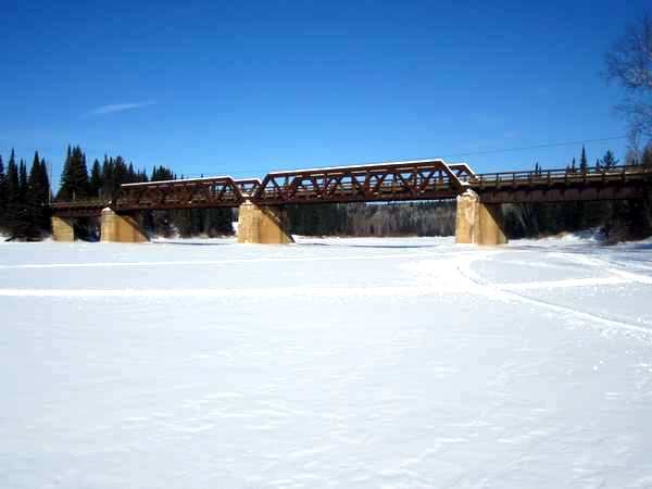
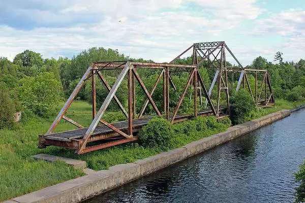
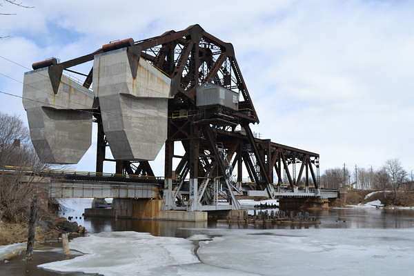
The Kaministiquia River Swing Bridge, Thunder Bay, ON
It is a steel throughtruss built in 1909. Was built by the Grand Trunk Railway. It is still used by CNR. The approaches to the bridge were burnt in a fire in October of 2013. Train traffic has resumed, but not vehicle traffic. This bridge is listed on the Ontario Heritage Bridge list. |
| This picture was taken and submitted by Tim Lukinuk, Thunder Bay, ON | |
 |
CNR Mckellar Lift Bridge � Scherzer rolling lift bridge 1911.
Thunder Bay Ontario. McKellar River between
the Mission and Mckellar Islands. Note the Sleeping Giant in the background.
|
| This picture was taken and submitted by Tim Lukinuk, Thunder Bay, ON | |
 |
CNR Kaministiquia Bascule Lift Bridge - Strauss
Thunder Bay, ON It is a trunion bascule bridge built in 1911 This bridge is listed on the Ontario Heritage Bridge list. |
| This picture was taken and submitted by Tim Lukinuk, Thunder Bay, ON | |
 |
CNR Kaministiquia Bascule Lift Bridge - Strauss
Thunder Bay, ON It is a trunion bascule bridge built in 1911 This bridge is listed on the Ontario Heritage Bridge list. |
| This picture was taken and submitted by Tim Lukinuk, Thunder Bay, ON |
| Privacy Policy for http://yourrailwaypictures.com/
If you require any more information or have any questions about our privacy policy, please feel free to contact us by us by email at [email protected] At http://yourrailwaypictures.com/, the privacy of our visitors is of extreme importance to us. This privacy policy document outlines the types of personal information is received and collected by http://yourrailwaypictures.com/ and how it is used. Log Files
Cookies and Web Beacons
DoubleClick DART Cookie
Some of our advertising partners may use cookies and web beacons on
our site. Our advertising partners include ....
These third-party ad servers or ad networks use technology to the advertisements and links that appear on http://yourrailwaypictures.com/ send directly to your browsers. They automatically receive your IP address when this occurs. Other technologies ( such as cookies, JavaScript, or Web Beacons ) may also be used by the third-party ad networks to measure the effectiveness of their advertisements and / or to personalize the advertising content that you see. http://yourrailwaypictures.com/ has no access to or control over these cookies that are used by third-party advertisers. You should consult the respective privacy policies of these third-party ad servers for more detailed information on their practices as well as for instructions about how to opt-out of certain practices. http://yourrailwaypictures.com/'s privacy policy does not apply to, and we cannot control the activities of, such other advertisers or web sites. If you wish to disable cookies, you may do so through your individual browser options. More detailed information about cookie management with specific web browsers can be found at the browsers' respective websites. |